


 |
Geography of New Zealand |
|
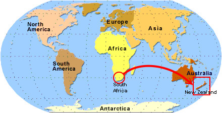
New Zealand is a tiny island country 11, 663 kilometers east of South Africa situated in the Pacific Ocean. Our nearest neighbours are Australia and the Pacific Islands. The area of sea between New Zealand and Australia is called the Tasman Sea, but is generally refered to as “the ditch” and is around 2000km wide
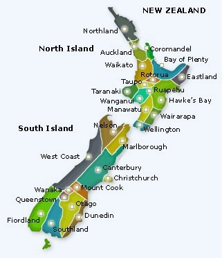
The country consists of two main islands and many smaller ones. The two islands don’t have official names and are just refered to as the North Island and the South Island. (The smaller island you can see on the map above situated just below the South Island is called Stewart Island.).
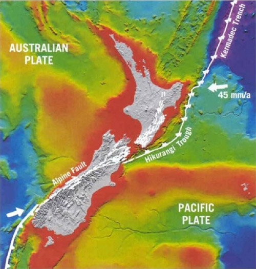
The country is situated on the boundary between two fault lines. These fault lines are moving towards each other at a rate of 45mm per annum. As a result there are around 14 000 earthquakes in New Zealand every year. Most so small that you can’t feel them. It also means that there are volcanically active areas throughout the North Island. Being a country made up of islands there is also 18 000 kilometers of coastline that you can enjoy. In fact no matter where you live in New Zealand, you are never more than 130 kilometers away from the sea |
|
 .
.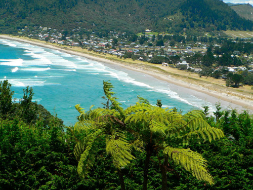
Here are some typical scenes you will see around the North Island
and the South Island